For any given location on Earth, a total solar eclipse will occur on average once every 360 years. And for parts of Australia and New Zealand it will be their turn on Saturday 22nd July 2028.
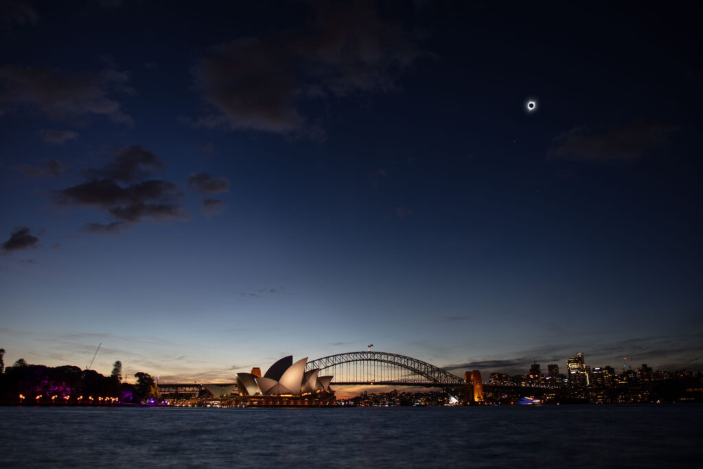
To provide some idea what 4 minutes of darkness would look like, I decided to created a composite image of the event combining it with one of the most iconic scenes known across the world, that of the Sydney Opera House and the Sydney Harbour Bridge.

Creating an accurate composite
So you are probably asking yourself, how accurate can this image be 5 years out from the event even occurring? Well I must admit I can’t predict the weather and that will truly be in the hands of the gods on the day. But I’ve tried to make everything else in this shot as accurate as possible.
Let me take you through the process.
Planning the shot
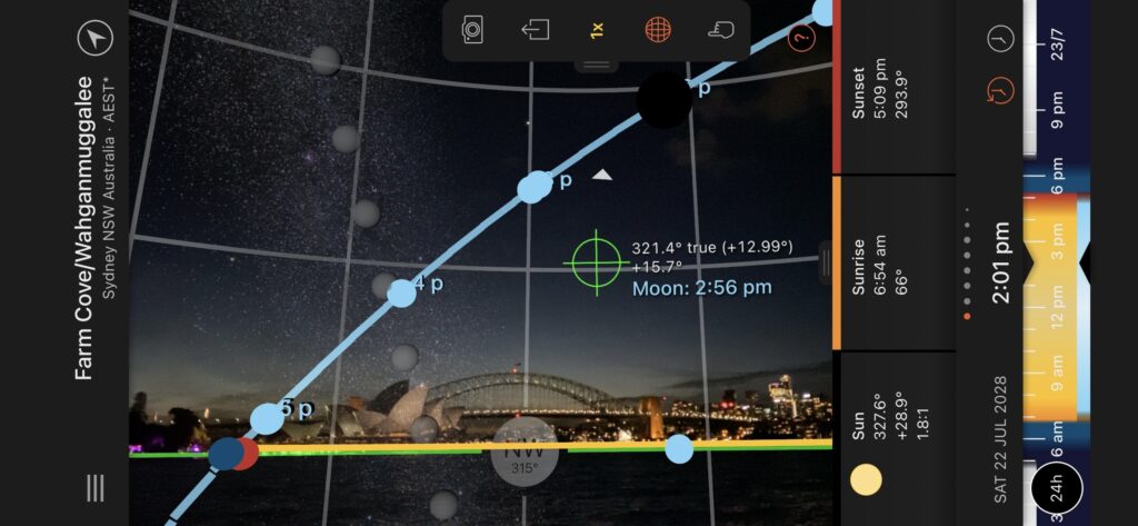
The first tool that I used was Sun Surveyor on my iPad. This allowed me to determine the location of where the Sun and Moon will be and then looked at the best spot to start planning out where to take a photo from. It was pretty obvious that a location in the Royal Botanic Gardens was going to be ideal with uninterrupted views across Farm Cove.
Taking the shot
Next step was to take some photos down at Farm Cove in roughly the same position as Sun Surveyor. It was just a matter of utilising the live augmented view to ensure that I had the framed the shot and included the patch of sky where the Moon and Sun would be.
And this is the beautiful thing about using the tool, being able to set the date/time five years into the future.
I captured a number of pictures across a variety of shutter speeds to ensure that I had captured some additional stars and planets. These would later act as reference points in post production.
Post production workflow
On reviewing the 40 or so pictures that I had taken I settled on the one that had what I felt was the right exposure along with some visibile starts and planets.
The next tool that I planned to use was Stellarium an open-source planetarium. Similar to Sun Surveyor, it also works by utilising your Earth based co-ordinates and either current or user specified date/time to display to display what the sky would look like. It was then just a matter of grabbing some star fields, one for when I took the original photo and the second for 22nd July 2028 @ 2.01pm AEST.
Then it was over to Photoshop to do the following.
- Add original image as background layer
- Add star field image for current date/time as a new layer
- Add star field image for 22nd July 2028 as a new layer
- Position, rotate and scale star field layers to align to stars and planets on original image
- Remove existing stars from original image background layer
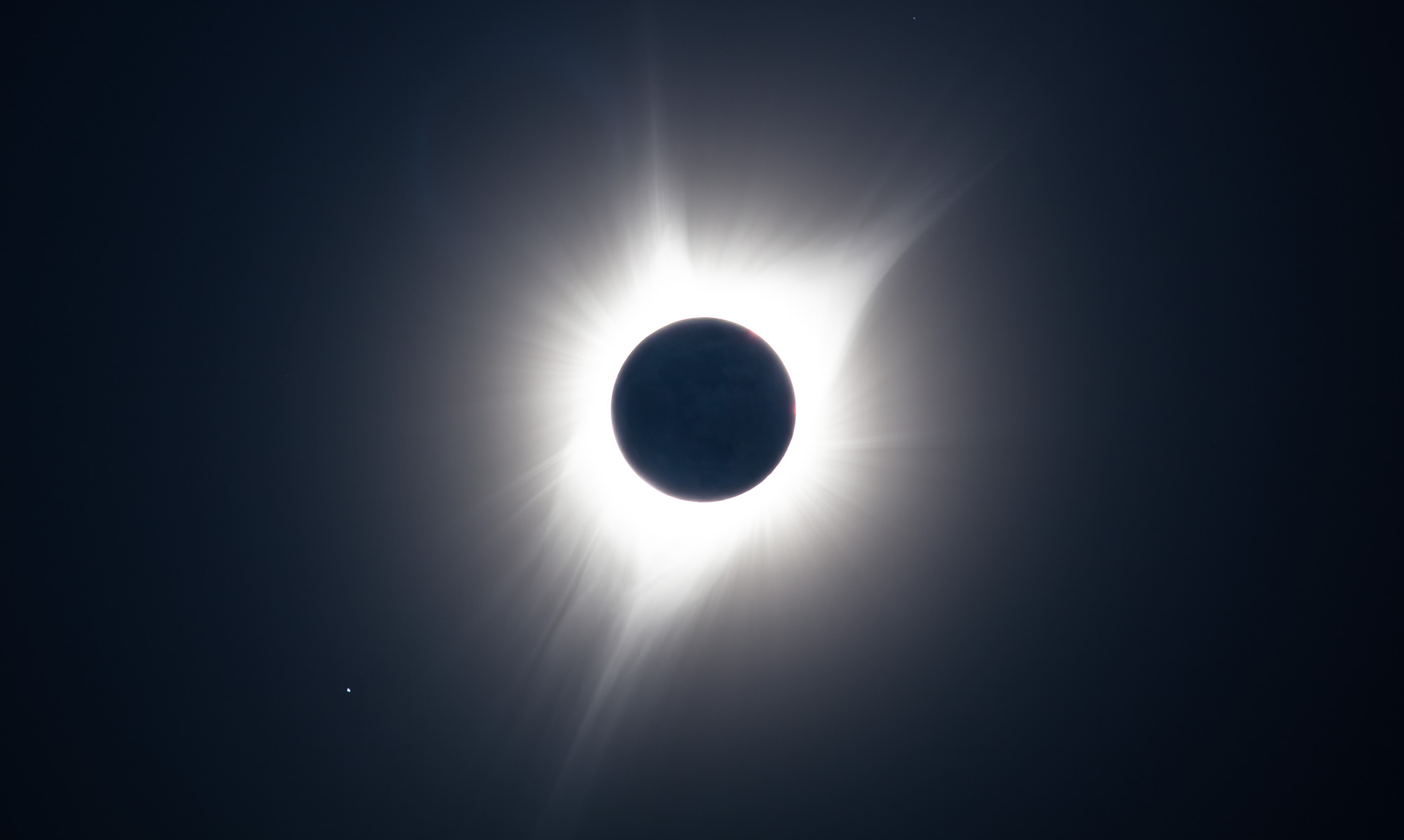
- Add image from August 2017 total solar eclipse as a new layer
- Position and scale August 2017 total solar eclipse image layer to align with camera lens of original image
- Add planet to represent Mercury position at time of eclipse
- Add star to represent Pollux position at time of eclipse
Final tweaking of the image was then performed in Lightroom.
- Apply linear gradient to have a darker sky to represent the umbra (total eclipse) on the right hand side of the image, whilst the left hand side is lighter representing the penumbra (partial eclipse).
Final thoughts
I’m delighted with the final product. It’s by no means perfect and assumes that the weather will be kind to observers on the day.
If you are interested in learning more about the path of totality then I highly recommend this interactive Google Map.
http://xjubier.free.fr/en/site_pages/solar_eclipses/TSE_2028_GoogleMapFull.html
Simply click on the map to see how long the eclipse will be for a particular location.
Enjoy!

